The budget includes nearly $400 million for major construction projects across the valley aimed at improving the resiliency and capacity of the valley’s water system.
The budget includes nearly $400 million for major construction projects across the valley aimed at improving the resiliency and capacity of the valley’s water system.

If the bill were to become law, Nevada would be the first state to give a water agency the power to cap the amount of water that flows into individual homes.

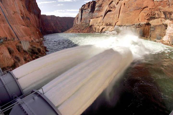
A torrent of water was released from Glen Canyon Dam last month as a way of shoring up the sandbars and beaches along the Colorado River.
Lake Mead is planning to close a boat ramp and move some toilets and dumpsters to prepare for an influx of water from Glen Canyon Dam.

The Nevada Assembly voted 30-12 in favor of a wide-ranging water conservation bill that could lead to caps on residential water use in Las Vegas.
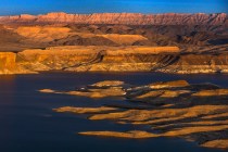
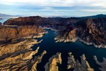
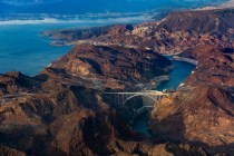
After dropping more than 50 feet since 2000, latest forecasts show Lake Mead rising by roughly 22 feet by the end of the year.

The U.S. Drought Monitor says storms dropped so much water this winter that less than one-quarter of Nevada remains in drought.
The two proposals show that “the tools available to the federal government are very blunt,” said John Entsminger, general manager of the Southern Nevada Water Authority.
Since the 1980s, Southern Nevada has been banking its unused Colorado River water, storing hundreds of billions of gallons away underground and in Lake Mead.

The federal government laid out a pair of options to cut water use along the Colorado River and keep Lake Mead and Lake Powell from shrinking any more.
If approved, the legislation would make Nevada the first state to give a local water agency permanent say over how much water residents can use.
Forecasters expect the Colorado River to see some of its highest flows in more than a decade as snow melts off the Rockies this spring and summer.

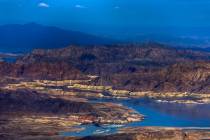
A new ramp was to allow slightly more access to declining Lake Mead, but the effort has been slowed.

Nevada gets less than a 2 percent cut from the Colorado River’s waters, but the state actually uses far more water than that each year.

A bill would create a new program to use satellite imagery to estimate how much water is lost to evapotranspiration from crops.